Map Data Layer Files
Lesson Overview:
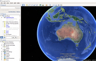
These zipped .KMZ and .KML data layer files for student mapping activities are available to download to accompany ForestLearning ForestVR teaching and learning resources for Geography. These files are compatible to be uploaded as layers for use within Google Earth and other online mapping platforms that support these files.
Data layer locations are provided for the forests, timber mills and processing facilities that are explored in the teaching resources below that accompany ForestVR 360 expriences and virtual 360 tours. Other global and Australian sites referenced within the teaching resources are also available as data layers to download.
Teaching resources linking map data layers – .kmz and .kml files:
– Geography Year 8: Forest Landscapes
– Geography Year 10: Environmental Change and Forest Management
Year Level/s:
Key Curriculum Areas / Subject:
N/A
National Curriculum Codes:
N/A
Strand Content Description:
N/A
General Capabilities:
Cross Curriculum Priorities:
Curriculum Connections:
ScOT Catalogue Terms:
N/A
Theme/s:
Resource Type/s:
Primary:
Spatial Mapping FilesSecondary:
Online Learning
student Resource
Hinterland Wildlife Corridor Data Layers
Hinterland Wildlife Corridor.kml file (4MB compressed file, 31MB true size)
File Size: 3.93 MB
File Type: zip
Loginstudent Resource
student Resource
ForestVR Spotted Gum Forest Locations
Includes: - 11 .kmz files - Hurfords Green Mill jpg file - Hurfords Green mill process animated map.pdf file
File Size: 6.53 MB
File Type: zip
Loginstudent Resource
student Resource
Tree coverage layers
Includes: - Australian State map layers for tree coverage (.kmz files) - Forest Cover Graph (.crtx file) - Graph Tree Coverage (.jpg file)
File Size: 36.52 KB
File Type: zip
Login